
Mount Pleasant · 2026 Market UpdateMount Pleasant Real Estate in 2026: One Town, Two Different Market ProfilesThe latest numbers show a market that is still moving — but pricing,
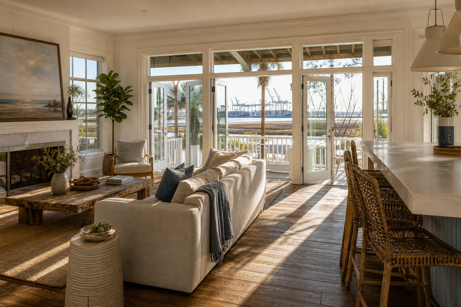
Charleston's port expansion supports regional job growth and infrastructure investment, but the effect on home values is location-specific. Waterfront neighborhoods closest to freight corridors face noise and traffic tradeoffs, while areas like Daniel Island benefit from port-driven employment without direct industrial adjacency.
The Short Answer: Location Determines the Impact
The answer depends heavily on where the home sits relative to port operations. Port-driven job growth and infrastructure investment tend to support broader Charleston home values over time, but neighborhoods immediately adjacent to freight corridors, rail lines, and truck routes can face real tradeoffs in noise, traffic, and buyer perception. The value story is not uniform across the metro, it's block-by-block and neighborhood-by-neighborhood.
This is one of the questions I hear most from buyers and sellers right now, and it's worth unpacking carefully. Let me walk you through what the port expansion actually means, which neighborhoods feel it most, and how to think about long-term appreciation versus near-term livability.
What the Port Expansion Actually Did, and Why It Matters for Housing
In February 2025, the U.S. Army Corps of Engineers, Charleston District confirmed that the Charleston Harbor Deepening Project had reached its target depth of 52 feet. That milestone allows the port to handle the largest container ships currently in commercial service, which puts Charleston in direct competition with the biggest East Coast ports for long-haul cargo volume.
What does a deeper harbor mean for housing? Directly, not much. Indirectly, quite a bit. A higher-capacity port attracts more logistics investment, more distribution infrastructure, and more employers who need proximity to a major maritime gateway. That translates into jobs, and jobs translate into housing demand. The Bureau of Labor Statistics Southeast regional office tracks South Carolina's metro employment data, and the Charleston MSA has consistently outpaced national employment growth as port-related industries expand.

The key distinction I draw for my clients is this: port-led economic growth lifts the whole Charleston market, but it doesn't lift every neighborhood equally. Some areas benefit from proximity to employment hubs and improved infrastructure. Others absorb the friction of increased freight volume, truck traffic on I-526, rail activity near the neck area, and industrial noise in corridors that buffer the terminals from residential streets.
Daniel Island: The Port-Adjacent Neighborhood That Largely Avoids Port Friction
Daniel Island is a useful case study. It sits near the Wando Terminal corridor and has direct I-526 access, which makes it attractive for professionals working in port-adjacent industries. But the neighborhood is buffered from the heaviest freight operations by geography and road design. If you want a deeper look at what daily life there actually looks like, I wrote about it in detail here: Is Daniel Island a good place to live?
The value story on Daniel Island is tied more to commuter access, lifestyle amenities, and the quality of its master-planned infrastructure than to port operations directly. What buyers there should watch is regional road capacity. The South Carolina Department of Transportation manages bridge and corridor projects that directly affect Daniel Island commute times, and if bridge access tightens, that affects buyer demand. That's worth verifying before you make an offer or list a home there in 2026.

Neighborhoods Closest to Freight Corridors
Areas along the neck of the peninsula, parts of North Charleston near the terminal approaches, and neighborhoods that sit alongside active rail lines feel the port's growth differently. Increased cargo volume means more truck movements on surface roads, more rail activity at odd hours, and more industrial development pressure in adjacent parcels. For buyers considering these locations, those are real livability factors, not deal-breakers for everyone, but variables that affect resale velocity and the pool of future buyers.
The flip side is that some of these neighborhoods offer price points that reflect the tradeoff, and buyers who are less sensitive to noise or traffic can find value there that wouldn't exist in a purely residential corridor. The question is whether the long-term appreciation trajectory compensates for the near-term friction. That's a calculation that depends on your timeline, your tolerance, and your exit strategy, and it's exactly the kind of conversation I have with buyers before they commit.

Flood Risk: The Variable That Often Matters More Than Port Growth
Here's the honest truth about waterfront Charleston: for most buyers and sellers in 2026, flood exposure is a more immediate driver of home value than port expansion. The two issues often overlap geographically, waterfront properties near the port corridor are frequently in high-risk flood zones, but they operate on different timelines and affect different line items in a transaction.
Charleston County and the City of Charleston continue to face recurring high-tide flooding and storm-surge exposure. The FEMA Flood Map Service Center is the starting point for any neighborhood-level flood screening, and the City of Charleston's floodplain management resources provide local context that the federal maps alone don't capture. Before you price a waterfront listing or make an offer on one, knowing the flood zone designation and the current flood insurance cost is non-negotiable.
Flood insurance costs have shifted materially in recent years under FEMA's Risk Rating 2.0 methodology. A property that looks attractively priced on a per-square-foot basis can carry annual insurance costs that change the effective cost of ownership significantly. I always make sure my buyers understand that number before they fall in love with the view.
The National Flood Insurance Program and private flood market options both apply in Charleston County, and the right choice depends on the specific property's elevation, construction type, and flood zone. Your lender and your insurance agent need to be part of that conversation early.
| Neighborhood Type | Primary Value Driver | Key Risk Factor | Port Growth Benefit |
|---|---|---|---|
| Daniel Island | Commuter access, master-planned amenities | Bridge/road capacity | Indirect (employment base) |
| Waterfront Peninsula/Neck | Urban proximity, lifestyle premium | Flood exposure, freight noise | Mixed (jobs vs. freight friction) |
| North Charleston (port-adjacent) | Price point, industrial proximity | Truck/rail noise, industrial pressure | Direct (logistics employment) |
| Mount Pleasant / Isle of Palms | Coastal lifestyle, school access | Flood risk, insurance costs | Indirect (regional job growth) |
| Downtown Charleston | Historic character, walkability | Flood, parking, density | Indirect (tourism, hospitality) |
For a broader picture of how coastal demand plays out across the East Cooper corridor, my post on living in Mount Pleasant covers the lifestyle and market dynamics that make that submarket tick, including the infrastructure pressures that affect daily commutes.
What Buyers and Sellers Should Actually Do With This Information
Port growth is a long-term tailwind for the Charleston metro. The 52-foot harbor depth keeps Charleston competitive for the next generation of cargo volume, and that employment anchor matters for regional housing demand. According to Zillow Research, Charleston remains one of the more expensive housing markets by Southeast standards, a reflection of that sustained demand pressure.
But "the metro is strong" doesn't tell you whether the specific property you're buying or selling is well-positioned. Here's how I frame it for my clients:
If you're buying near a freight corridor, verify the current truck route and rail activity before you go under contract. Drive the neighborhood at 6 a.m. on a weekday. Look at the FEMA flood map. Get a flood insurance quote before your due-diligence period ends. The National Association of Realtors consistently finds that buyers who do neighborhood-level due diligence have fewer post-closing surprises, and in Charleston's coastal market, that research is especially worth doing.
If you're selling a waterfront or port-adjacent property, the disclosure obligations matter. South Carolina uses a Residential Property Condition Disclosure Statement as the standard seller disclosure document. Disclosure requirements can vary depending on exemptions and property type, so confirm the applicable rules with your closing attorney. In South Carolina, a licensed attorney handles the residential closing process and records the deed with the Charleston County Register of Deeds. The South Carolina Bar can point you toward a real estate attorney if you don't already have one.
On closing costs broadly: the Charleston County Register of Deeds charges a deed recording fee based on document type and page count, that's a county process, not a negotiated closing cost. Other costs at closing vary by transaction and are typically negotiated between the parties. Broker fees and commissions are fully negotiable and not set by law, there is no standard or fixed rate. The listing fee is set in your listing agreement, and any compensation a seller chooses to offer a buyer's agent is optional and separately negotiable. Your closing attorney will walk you through the specifics of your transaction.
Recent Zillow market data for the Ion neighborhood shows a median sale price of $349,700, with homes averaging 49 days on market and 60 active listings currently available. That's area-level context, an individual home's value depends on condition, street, build year, and timing. Your specific number requires a current market analysis, not a metro average.
Every situation is different, and the only way to know whether port-driven growth helps or hurts your specific property is to run the numbers with someone who knows this market at the neighborhood level. That's exactly what I do before we list or before a buyer makes an offer.
You can read what past clients have said about working with me on Zillow and Realtor.com.
Frequently Asked Questions
Will Charleston port expansion raise home values near the waterfront?
Port expansion supports the broader Charleston employment base, which sustains regional housing demand over time. But the effect on individual waterfront properties is not uniform. Homes buffered from freight corridors tend to benefit more cleanly from port-driven job growth, while properties immediately adjacent to truck routes, rail lines, or industrial uses face livability tradeoffs that can temper appreciation. Location within the metro matters more than proximity to the port in general.
Does port traffic hurt resale values in Daniel Island or downtown Charleston?
Daniel Island is largely buffered from direct port freight traffic by its road layout and geographic position, so its value drivers are more about commuter access and lifestyle than industrial adjacency. Downtown Charleston's value story is driven by historic character and urban demand, with flood risk being a more significant variable than port noise for most properties there. Neither submarket is immune to regional infrastructure pressure, but neither faces the direct freight-corridor friction that some North Charleston neighborhoods do.
Which Charleston neighborhoods are most exposed to noise from port trucks and rail?
Neighborhoods along the neck of the Charleston peninsula, parts of North Charleston near the terminal approach roads, and areas adjacent to active rail corridors feel the most direct impact from port freight movement. Truck traffic on I-526 and surface connectors affects commute times across a wider area. If noise and traffic are concerns for you, I'd recommend driving the neighborhood at peak freight hours before making a decision, the difference between corridors can be significant.
How much does flood risk matter compared to port growth for waterfront home values?
For most waterfront properties in Charleston in 2026, flood risk is the more immediate financial variable. Flood insurance costs under FEMA's current Risk Rating 2.0 methodology vary significantly by property, and a high annual premium can materially affect the effective cost of ownership and future buyer demand. Port-driven growth is a long-term tailwind for the metro, but flood exposure is a near-term cost that shows up in every transaction. Check the FEMA Flood Map Service Center and get an insurance quote early in your due-diligence process.
Are buyers in Charleston paying more attention to bridge access and commute times in 2026?
Yes. With continued growth in East Cooper and on Daniel Island, bridge capacity and road connectivity have become real factors in buyer decisions. The South Carolina Department of Transportation manages the corridor and bridge projects that affect these commutes, and any significant construction or capacity constraints can shift buyer preference between submarkets. It's worth checking current project status before committing to a neighborhood where a single bridge is the primary access route.
What disclosures do Charleston sellers give when a home is near the port or in a flood zone?
South Carolina sellers typically complete a Residential Property Condition Disclosure Statement as part of the listing process. Disclosure requirements can vary based on exemptions and property type, so confirm the applicable rules with your closing attorney before listing. Flood zone status is a material fact that affects buyer financing and insurance, and it should be addressed clearly in the transaction. Your attorney handles the closing and deed recording with the Charleston County Register of Deeds.
Port growth is a genuine long-term asset for Charleston real estate, but translating that into a smart decision for your specific property takes local knowledge, current data, and an honest look at the tradeoffs. That's the conversation I'm here to have.
If you're weighing a waterfront purchase or thinking about listing a property near the port corridor, connect with me directly and we'll work through your specific situation. Or if you want a current read on what your home is worth in this market, request a private home valuation and I'll get you a number grounded in what's actually selling right now.

Local Perspective. Current Market Intelligence.
Explore more Charleston real estate insights in The Journal or review the latest coastal market statistics and trends.
Gary Langhoff, known as MrRealEstateSC, is a Charleston luxury real estate advisor with more than 14 years of experience serving buyers and sellers across Isle of Palms, Sullivan's Island, Daniel Island, and Mount Pleasant. He was the #1 individual agent on Isle of Palms in 2025 by sales volume, with $192M+ in career sales. He holds Certified Luxury Home Marketing Specialist designation with Million Dollar Guild Elite status and is RealTrends Verified in the top 1.5% of agents nationwide.
The Boulevard Company · 843-810-3400
Equal Housing Opportunity. Gary Langhoff is licensed with The Boulevard Company, regulated by the South Carolina Real Estate Commission. This article is general information only and does not constitute legal, tax, or financial advice. Confirm your specific costs, disclosures, and closing details with your attorney, tax advisor, lender, or closing officer.
 The data relating to real estate for sale on this web site comes in part from the Broker Reciprocity Program of Charleston Trident Association of REALTORS® -- All information deemed reliable but not guaranteed. All properties are subject to prior sale, change or withdrawal. Neither listing broker(s) or information provider(s) shall be responsible for any typographical errors, misinformation, misprints and shall be held totally harmless. Listing(s) information is provided for consumer's personal,
